भारत रत्न बाबासाहब भीमराव अम्बेडकर राजकीय इंजीनियरिंग कॉलेज प्रतापगढ़
BHARAT RATNA BABASAHEB BHIMRAO AMBEDKAR RAJKIYA ENGINEERING COLLEGE PRATAPGARH
(State Funded Government Autonomous Institute and Affiliated to AKTU Lucknow)
College Code-1216
Surveying and Geomatics Lab
Home
Surveying and Geomatics Lab
Surveying and Geomatics Lab
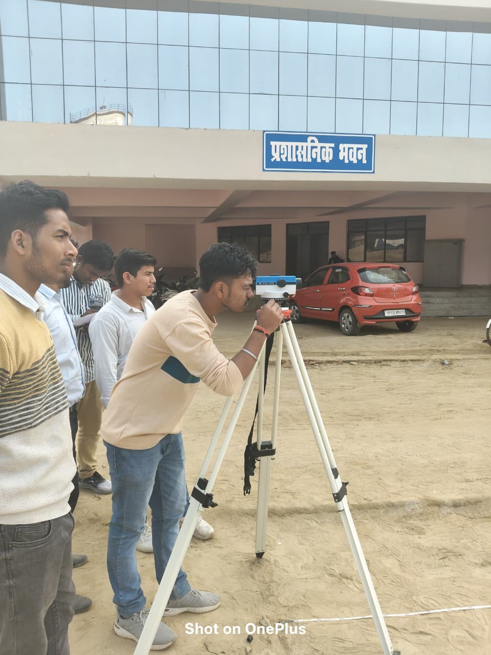
The Surveying and Geomatics Lab focuses on techniques and instruments used to measure and map the Earth’s surface. It provides practical training in land surveying methods, including total station surveys, levelling, and GPS measurements. Students learn to collect accurate spatial data for engineering projects, land development, and construction activities.
List of Experiments
- To measure bearings of a closed traverse by prismatic compass and to adjust the traverse by graphical method.
- To find out reduced levels of given points using auto/dumpy level.
- To study parts of a Vernier and electronic theodolite and the measurement of horizontal and vertical angles.
- To measure the horizontal angle between two objects by the repetition/reiteration method.
- To determine the height of a vertical structure (e.g. chimney/ water tank, etc.) using trigonometrical leveling by taking observations in a single vertical plane.
- To set out a simple circular curve by Rankine’s method.
- Demonstration and working on Electronic Total Station. Measurement of distances, horizontal & vertical angles, coordinates and area of a land parcel.
- Demonstration and working with Mirror stereoscopes, Parallax bar and Aerial photographs.
- Visual Interpretation of standard FCC (False colour composite).
- Digitization of physical features on a map/image using GIS software.
- Coordinates measurement using GPS.
- Demonstrate working of a Drone for survey of given field.